
Surveying
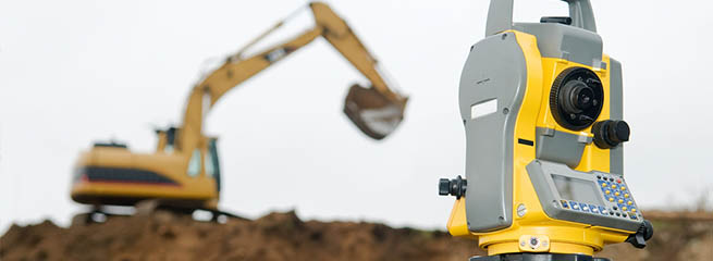
Our firm has the experience of six Professional Land Surveyors, five licensed in Nevada and one licensed in both California and Nevada. Our team of licensed land surveying professionals has more than 30 years of experience and expertise in the generation and review of final maps, parcel maps, reversion to acreage maps, amended maps, lot line adjustments, mergers and certificates of compliance.
Having professional survey staff in-house is invaluable for completing projects in a timely and cost-effective manner. Our surveying services regularly include coordination with company crews, outside consultants, and various governmental agencies. We work closely with contractors to stake out elevations at top of pipe or inverts; provide stakes; stake offsets from back of curb, centerline, right-of-way, or property line. Additionally, we provide as-built surveys during construction so that a precise database can be compiled as required by many governmental agencies.
In addition to mapping services, our survey department handles a variety of surveying assignments, including:
- Traditional survey and Global Positioning System (GPS) methods for construction staking, right-of-way surveys, horizontal and vertical control networks, and boundary surveying projects
- Advanced surveying technology, such as GPS, which affords us efficiencies in precisely locating reference points and establishing control networks
- Field topographic surveys
- Patent research of legal records for property lineage evidence
- Analysis of historical boundaries
- Hydrographic surveys
- Digital utility database mapping in AutoCAD or ArcMap (ArcView/Arc Info) GIS compatible formats,
- LIDAR validation surveys
- Patent research including the assembling of old notes and paper plats of surveys dating back to the initial transfer of land titles from the federal government forward to present-day ownership
- Preparation of legal descriptions, deeds, and exhibits for inclusion in boundary line adjustment and easement documentation
Success Story
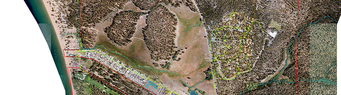
Utility Mapping Helps Sewer System Emergency Repairs
The Problem:
Douglas County Sewer District #1, located within the sensitive Tahoe Basin, is responsible for the collection and treatment of sewage generated within the Stateline area, including the casino core along U.S. Highway 50 along the sensitive Lake Tahoe Basin. There was no accurate information available regarding the location of many existing facilities, which made emergency repairs of underground facilities very difficult, particularly during heavy winter snow.
The Solution:
R.O. Anderson collected all available AutoCAD drawings, as well as hard copy record drawings of the District’s collection system, and organized them into a single AutoCAD compatible drawing file. The survey crew then undertook the task to precisely locate all above ground infrastructure, manholes, valves, service lines, and lift stations using a GPS data collection receiver. In areas where GPS did not yield such accuracies (e.g. heavy tree canopy, obscured sky, etc.) conventional surveying techniques were used to meet an identical accuracy standard for those locations. R.O. Anderson also coordinated the contract and services for high-resolution orthorectified photogrammetry which was incorporate into the field-grade survey data to locate existing facilities, including both rim and invert elevations of gravity facilities, necessary to prepare district-wide mapping..
The Results:
The data was collected and incorporated into the District’s Geographic Information System. We produced system-wide color mapping booklets which were made available in the District vehicles to assist in performing field locates. Finally, facilities mapping data was entered into Delorme hand-held GPS units for use by District personnel to field locate facilities.