Hydrology/Hydraulics

R.O. Anderson personnel are characterized by special expertise in the field of hydrology and hydraulics. Dr. Thompson is an expert in solving surface and ground-water hydrologic problems through application of numerical and statistical models and the collection and analysis of field data. We are regularly retained to evaluate and analyze complex hydraulic conditions of riverine floodplains, to evaluate the hydrology of both large and small watersheds for the purpose of estimating peak discharges and designing regional drainage mitigation works, and to evaluate and design diversion works and stream bank stabilization measures to protect adjacent lands.
Our Hydrology/Hydraulics expertise lies in:
- Evaluating and analyzing complex hydraulic conditions of riverine floodplains
- Evaluating the hydrology of both large and small watersheds for the purpose of estimating peak discharges
- Designing regional drainage mitigation works
- Evaluating and design diversion works and stream bank stabilization measures to protect adjacent lands.
Our computer modeling capabilities include the proficient use of HEC-RAS, HEC-HMS, DAMBREAK, PRMS/MMS, HEC-1, HEC-2, and Bentley’s suite of hydraulic software, including PondPak and StormCAD. When warranted, we also perform two-dimensional modeling of complex floodplains using the FLO-2D, RMA2, or FESWMS codes. In addition, we routinely prepare all supporting materials for applications to the Federal Emergency Management Agency (FEMA) for floodplain modifications, including Conditional Letter of Map Revisions, Letter of Map Revisions, and Letter of Map Amendments.
Typical storm drainage infrastructure design by R.O. Anderson personnel includes collection, gravity transmission, and detention with treatment. A variety of software programs/routines are used to model water, sewer and storm drainage infrastructure.
Success Story
Carson River Watershed Discovery Project


The Problem:
Within the Federal Emergency Management Agency’s (FEMA) Risk Mapping, Assessment, and Planning (Risk MAP) Program, the Discovery process is intended to initiate watershed-wide discussions about increasing resilience to flooding. The goal of Discovery is to determine which areas within a watershed require mapping, risk assessment, or mitigation planning assistance.
The Solution:
R.O. Anderson coordinated with stakeholders from the six counties within the Carson River watershed (Alpine County, California; Carson City, Churchill County, Douglas County, Lyon County, and Storey County, Nevada) as well as additional stakeholders including the Nevada Division of Emergency Management, Nevada Division of Water Resources, National Oceanic and Atmospheric Administration (NOAA), Truckee Carson Irrigation District, U.S. Army Corps of Engineers, U.S. Bureau of Reclamation, and U.S. Geological Survey, and FEMA to collect data and information regarding flood issues, flood risk, and flood mitigation capabilities within the Carson River watershed.
R.O. Anderson and the Carson Water Subconservancy District initiated two Discovery Meetings to engage the stakeholders in the review and validation of available flood data, as well as to discuss flood history, catalog areas at risk for flood loss, examine development plans, review the adequacy of existing hazard data, assess mapping needs, and discuss community activities that relate to flood risk and solutions for reducing flood risk.
The Results:
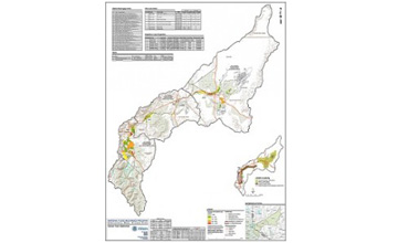
R.O. Anderson inventoried and analyzed the data including hazard mitigation plans, National Flood Insurance Program mapping needs, socio-economic data, flood control structures, community assistance visits, regulatory mapping, ongoing and completed watershed projects, and future project needs, and then summarized the information gathered as part of the Discovery process into the Carson River Watershed Discovery Report. This task included the preparation of base GIS mapping to visually display the information received onto Discovery Maps.
