Success Stories
Genoa Lakes Golf Resort & Montaña Development

The Problem:
The Owner wanted to develop this former 3,000 acre ranch and skeet shooting range into an upscale residential development. This project was complicated by its unique location on both sides of a former state highway, the lack of existing infrastructure, the lack of appropriate zoning, and the requirements to develop surface- and ground-water resources. Because of site constraints, including steep topography, wetlands, and alluvial and riverine floodplain areas, this project required substantial communication with both the client and Douglas County, as the primary permitting agency. In addition, we were tasked with protecting and preserving adjacent farmlands.
The Solution:
We developed an approach to entitlements for the overall project that examined what the County wanted as part of its infrastructure master plan for the area, assisted the nascent redevelopment agency by incorporating a portion of the site within the redevelopment area, and promoted a development approach that preserved over 2,000 acres of ranchland and wetlands for perpetuity. Our approach assisted the County in developing a transferrable development rights program that has preserved over 15,000 acres in the Carson Valley.
The Results:
Our planning effort resulted in obtaining favorable master plan and zoning considerations that allowed for a 495-acre planned residential community and resort development, surrounded by nearly 2,200 acres of conservation and open space areas, contains 395 single-family home units, a clubhouse, physical fitness center, and Johnny Miller-designed championship golf course. Future plans include approximately 300 timeshare and fractional ownership units.
Parkway Vista Senior Affordable Housing
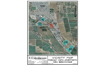
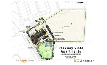
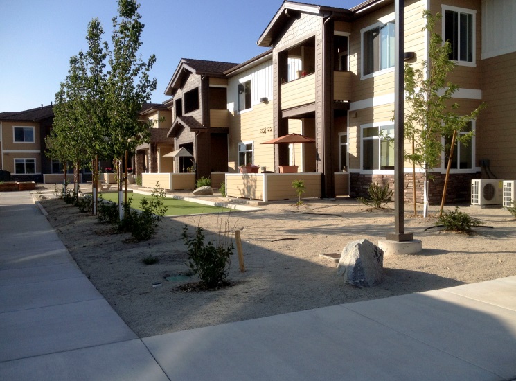
The Problem:
We were approached to assist an affordable housing developer in providing documentation supporting an application to the Nevada Housing Division for the Low Income Housing Tax Credit Program. The program deadlines had very tight timeframes. The client came to us without a particular location for the proposed project.
The Solution:
First, we identified a site that would be optimum for the location of his proposed project. After the client was able to secure this site, we prepared the civil and planning documentation necessary to submit to the Nevada Housing Division.
After the project was awarded the tax credits through a state-wide competitive process in September of 2012, we immediately proceeded with several, simultaneously expedited applications necessary to support the development plan and land acquisition, including an application to modify the planned development zoning, a tentative and final parcel map, a design review application and final civil site improvement plans for submittal to Douglas County. The 8.26 acre site includes a single 30-unit building for senior low income apartments, covered carport parking, a regional detention basin landscaped in a park-like setting, walking trails, xeriscaping and a community garden. Additionally, Phase 2 could include 42 more units.
The Results:
Final approvals for the development were received and the property welcomed their first tenant in January of 2014.
Pine to Park Path: City of Bishop, CA
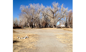
The Problem:
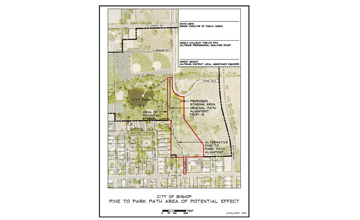
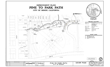
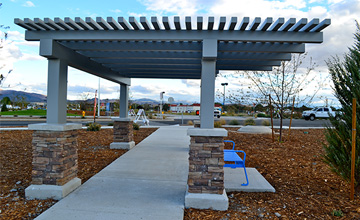
The City of Bishop is a small, incorporated town located within the Owens Valley portion of Inyo County. In 2009, we were selected to assist the City in preparing environmental and final design documents for a 1,000 foot long multi-modal trail connecting the City’s park to an adjacent neighborhood. Since Federal Transportation Enhancement funds were being utilized (Caltrans is the pass-through agency for the grant), it was necessary to prepare documentation to satisfy both CEQA and NEPA.
The Solution:
We served as the overall project manager. Working with environmental sub consultants to perform the required special studies and environmental documents, R.O Anderson, JBR Environmental and RMT, Inc. prepared the CEQA Initial Study in compliance with CEQA and a Categorical Exclusion with Studies for the purpose of NEPA compliance. The preparation of the Initial Study included consultation with responsible agencies, assessment of potential impacts to biological and cultural resources, field verification of potential impacts regarding wetlands and sensitive plant species and development of proposed mitigation and monitoring program for the project.
The Results:
Special studies conducted as a result of NEPA included a Visual Impact Assessment and Land Use and Community Impact Assessment Memorandum. We conducted a public information campaign, conducted a public workshop regarding the proposed trail, collected comments received at the workshop and assisted in preparing the final Initial Study, the Notice of Intent to Adopt a Negative Declaration and the Notice of Determination regarding the project. The project has a completed engineering design and construction is expected to be completed by the fall of 2014.
Virginia Ranch Specific Plan
The Problem:
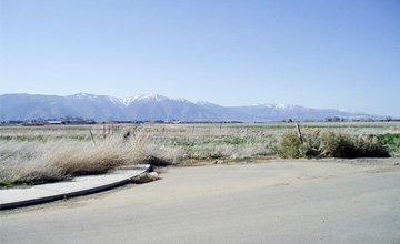
This 226-acre former ranch site, located in the southeast area of Gardnerville, presented multiple challenges on behalf of the developer. These challenges included issues relating to regional traffic improvements, requirements to utilize transferrable development rights, flood plains, community water and sewer connection and capacity issues, along with the zoning requirement for an integrated, long-term plan for this site as identified in the County’s Master Plan.
The Solution:
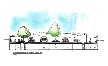
We were engaged to assess the feasibility of the proposal and prepare a 20-year Specific Plan for Virginia Ranch. We proposed a plan that includes 715 single-family detached residential units, 304 multi-family dwelling units, a 10-acre school site, an 8-acre industrial site and 23 acres of commercial zoning for a neighborhood shopping center. The community includes parkways along all streets and a combination of community and linear parks. Maintenance of these community facilities will be provided by the local municipality, satisfying the developer’s request to eliminate the requirement for a homeowners association. Furthermore, the developer requested the flexibility to sell “super pads” to individual builders who would design their own housing on those lots.
The Results:
During the project feasibility stage, our analysis showed that the County’s existing transportation plan was inadequate and could not convey the traffic load generated by the proposed project and meet minimum level of service standards. We identified and negotiated with off-site property owners for an alternative travel route to relieve potential traffic congestion points identified during the feasibility stage. This agreement also granted the developer vested development rights, which will allow the developer to make financial commitments for off-site improvements without the risk of subsequent growth control legislation.
Nevada Northwest Specific Plan

The Problem:
A private development company wished to entitle a 116-acre site located at a key focal point to the community of Minden, Nevada. After several meetings to program the client’s development interests for this property, members of our firm met with local officials to discuss the project and its overall importance to the community. The project was expected to be contentious with adjacent neighbors due to the inclusion of a casino/hotel within the project boundary. Additionally, a central feature of the planned community included the Martin Slough, a “Water of the U.S.”. Implementation of the plan required obtaining U.S. Army Corp of Engineers permits to create a functional wetland and joint-use facilities for walking trails, open space, and regional stormwater facilities that rely on biological treatment along Martin Slough.
The Solution:
We prepared a Specific Plan and Master Plan Amendment, which created the vision and implementation measures for an integrated mixed-use commercial and residential community using New Urbanism principles. The plan includes 800,000 square feet of commercial floor area, including a casino and hotel, a specialty shopping mall, vertically- and horizontally-oriented mixed-use, in addition to affordable and market rate housing opportunities. Working closely with the owner and local officials, our firm conducted community workshops to obtain community feedback, revised plans to reflect legitimate concerns, and presented the plans for public review a second time prior to submitting them for official review.
The Results:
Because this exhaustive public review process was used, the project was ultimately approved and adopted by Douglas County. Subsequent to the planning approvals, our firm was retained to perform street, drainage and utility design; hydraulic analysis of the Martin Slough floodplain to support infrastructure design of the Monte Vista Avenue crossing; boundary and topographic surveys; and construction stakeout.
